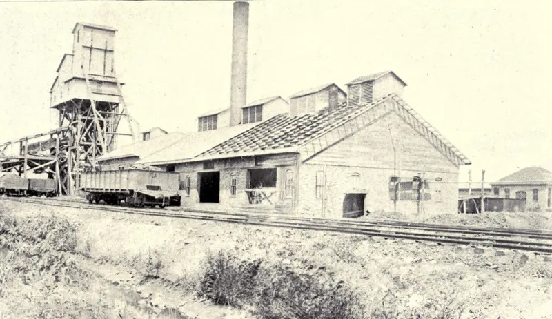
Macoupin County's coal lay deep. Outside a few creek valleys in the west, the main shafts listed in 1879 went 250 to 400 feet down before they reached the principal seam. The 1879 History of Macoupin County caught the industry early, at Carlinville, Staunton, Mount Olive, Virden and Girard. The 1911 history printed the county mine inspector's report for 1910, when 22 mines employed 4,681 people, Gillespie, Staunton and Virden had grown by three-quarters or more in ten years, and Benld counted 1,912 residents.
Written from 2 county histories, all free to read on the Internet Archive: History of Macoupin County, Illinois (1879); History of Macoupin County, Illinois, Vol. 1 (1911). Everything below comes from those books, and where they give an opinion, we say so.
What lay under the prairie
Both histories print the same geology chapter, which the 1879 book credits to the state geological report edited by A. H. Worthen. Every stratified rock in the county, it says, belongs to the coal measures, from coal No. 4 on Hodges' creek at the Greene county line up to coal No. 10, about 350 feet of rock in all. The seam that mattered was No. 5. It showed at the surface along streams on the western edge of the county, but in the central and eastern parts it took shafts three to four hundred feet deep. The book reckoned No. 5 alone held not less than 5,184,000,000 tons, enough for a million tons a year for 5,184 years, and put the county's total at more than ten billion tons.
At Virden the main coal averaged about seven and a half feet and sometimes reached eight; the 1879 book called it moderately soft and free-burning, breaking into cubic blocks like Belleville coal. The loose ground above the rock varied a great deal: 28 feet at a shaft near Bunker Hill, 20 at Virden, about 70 at Girard and 110 east of Staunton. Three miles south of Carlinville, T. L. Loomis sank a shaft 160 feet without reaching bedrock before water broke in, filled it to about 80 feet in a few hours, and ended the work. An analysis of No. 5 coal from the Hodges' creek mines by the late Henry Pratten of the geological survey found 6.50 percent moisture and 7.80 percent ash. The book judged it a good steam coal, hard enough to ship, and when carefully picked a good smith's coal.
Carlinville's shafts and the hillside pits of the west
The 1879 history lists three mines at the county seat. The Weer shaft was sunk in 1867 by the Weer brothers, 266 feet to a six-foot vein. By 1879 it was run by the Carlinville Coal Company, with T. L. Loomis as manager and C. L. Hamilton as lessee, and hoisted about 500,000 bushels a year with 45 men "in good times." The shaft of Walters, Gray and Lorenz, sunk in 1869, went 280 feet to a vein six to seven feet thick, employing about 35 men and hoisting nearly 500,000 bushels. Coal from both was sold on the home market, to railroad companies, and shipped to neighboring towns. The South Shaft of Bartles & Son still hoisted by horse power.
State inspector Craig's tables, reprinted in the same book, give smaller figures for the Weer shaft (30 men, 370,028 bushels, owned by Weer Bros. and leased by T. L. Loomis), spell the horse-powered mine's owner H. Bartel, Sr., and add a Union Coal Shaft, 286 feet deep with 20 men, owned by "a Company." The geology chapter says the Carlinville mine was entirely free from water, its gangways as dry as if they had a waterproof covering.
In the west, coal was still dug from hillsides. Cannel coal was opened early on Matthew Newkirk's land in section 11, township 12 north, range 9 west, and John Carlin worked it for several years to supply the neighborhood. The seam was only eighteen inches to two feet thick, true cannel on top and common bituminous below. Two miles north of Scottville a lower seam was opened by tunnels driven into the hillsides. Craig lists Wm. Carlin's cannel coal drift at Scottville (two men, 3,000 bushels) and, at Chesterfield, T. Bielby's slope (one man, 6,000 bushels, $100 capital), Thos. Carr's slope (two men, 500 bushels) and W. K. Davis's 30-foot gin pit (four men, 10,000 bushels).
“Prices ranged high, and a ready market was found for all the coal that could be furnished…”
Staunton: Henry Voge, William Panhorst and the Wabash
Henry Voge was born at Opperhausen, Brunswick, Germany, on March 21, 1837, and trained as a stone cutter and mason. He left Germany in April 1856, at nineteen, wishing to be free of service in the German army, and went to work in the coal mines at Belleville, living in that area thirteen years. For twenty-six months he also sold coal in St. Louis as agent of the German mining and coal company. He came to Staunton on June 1, 1869, and opened the first coal mine there, west of town.
When the Wabash railway came through, Voge went into partnership with William B. Panhorst to open a mine on the line. Work began in February 1871, the shaft went down 325 feet, and the first coal was shipped that October. Panhorst's sketch says many doubted it would pay and that he staked his whole fortune on it; prices ran high and a contract to supply the Wabash engines paid well. In April 1877 (Voge's sketch gives April 14) Panhorst sold out to Voge. He died June 23, 1879, in his fifty-second year, and was buried in the Ruther cemetery a mile north of Staunton. The two sketches each give their own man the credit: Panhorst's says he furnished the entire capital for the Staunton mine, Voge's that the first step toward developing Staunton's coal belonged to him.
By 1879 Voge's Staunton Coal Co. had two mines (the second sunk in 1876; the first shaft's date is unreadable in the scan), 325 feet to an eight-foot vein, employing 100 to 140 miners. In 1878 they raised nearly a million and a half bushels. The Western Coal Mines of Maxe and Sievers, run by Fred Dingerson, had a 220-foot shaft and an eight-foot vein but stood some distance from the railroad and were never worked as heavily. The 1879 railroad chapter credits the Wabash with opening several extensive mines around Staunton and Mount Olive.
Mount Olive: from Niemann's Settlement to a 400-foot mine
Until 1862 Mount Olive was known as "Niemann's Settlement," where its first preacher, Rev. C. F. Lochner of Pleasant Ridge, held services at John C. Niemann's home. The railroad called its stop Drummond Station before changing the name to Mount Olive. Laid out by Harbert J. Keiser and Meint H. Arkebauer, the town was incorporated in October 1874. In 1884 Staunton township was cut in half, and the north half became Mount Olive township.
The Mount Olive Coal Company sank its first mine in 1874 and its second in 1878. Both went 400 feet, the deepest in Craig's table, to a vein that averaged a full eight feet. The company employed 120 to 150 miners, and the book called both shafts quite dry.
The pit boss was James Hayes, in charge, his sketch says, since the mines opened in 1875. He was born at Newcastle-on-Tyne, England, on January 2, 1841, son of Joseph Hayes, a coal miner and "deputy" in the Newcastle pits, and went to work on top of the pits at twelve. He came to America in 1859 and repaired cars for the Madison county coal company on Wood river. In 1862 he enlisted in Company K, 80th Illinois; his brigade was captured six miles from Rome, Georgia, and he spent twelve days in the Belle Isle prison at Richmond before being exchanged. After Lookout Mountain the army set him to superintending the mining of coal at Chattanooga for the Tennessee river boats. He later built cars at O'Fallon until 1873 and mined at Moro until 1875. He married Ida Sathoff of Montgomery county in 1868; she died in 1875, leaving four children. John H. De Werff of Hesel, Prussia, who started Mount Olive's first brick-yard in 1875, also mined coal to some extent.
Virden, Girard, Nilwood and Bunker Hill in the 1879 tables
In Craig's tables the Virden shaft, owned by John Utt, went 320 feet to seven feet six inches of coal, employed 47 men, produced 750,000 bushels a year and carried $50,000 in capital, the most of any mine listed. The Girard shaft went 350 feet, with 14 men and 220,000 bushels; its owner is printed as B. Bogus. A shaft whose name the scan garbles, apparently Nilwood, went 330 feet with 10 men and 100,000 bushels, owned by Hy. Cooper. Staunton's shaft is credited with 100 men and 1,000,000 bushels, and Mount Olive's with the same, on $35,000 capital.
At Bunker Hill a shaft leased by Wm. Riel & Co. ran 250 feet with nine men and 125,000 bushels, and A. Duffey's horse-powered gin pit, 149 feet deep, employed ten men for 40,000 bushels. Staunton had a three-man gin pit as well.
The mines in 1910: Inspector Shanahan's report
The 1911 history prints the report of J. C. Shanahan, county inspector of mines, for the year ending July 1, 1910. The county had 17 shipping mines: Superior Coal Company Nos. 1, 2 and 3 and a Consolidated Coal Company mine at Gillespie; Consolidated Nos. 6, 7, 14 and 15 at Staunton; Consolidated No. 8 and Madison Coal Corporation No. 5 at Mt. Olive; Royal Colliery Company, Lukins & Andrews and Glenridge Coal Company at Virden; Girard Collieries Company; Vivan Colliery Company at Green ridge; the Carlinville Coal Company; and the Nilwood Coal Company. Five local mines were run by William Neil & Company, Bauser & Truesdale and Fritz T. Jardin at Bunker Hill and John J. Harbaugh and G. B. Loper at Chesterfield.
The 22 mines produced 4,040,436 tons worth $3,508,565 at the mine, 3,246,144 tons of it cut by 278 machines and 794,292 by hand. The workforce was 3,117 miners, 1,043 others underground, 150 boys underground and 371 above ground, 4,681 in all, and they used 66,552 kegs of blasting powder. The report counted four fatal accidents and 23 non-fatal ones that cost the injured thirty days or more.
Output fell 322,494 tons because every shipping mine stopped work from April 1 to June 1, 1910. On June 1 the Girard Collieries, Glenridge, Carlinville, Nilwood and Superior companies signed a scale with the United Mine Workers and went back to work. The price for hand mining rose from 55 to 58 cents and for machine mining from 48 to 51 cents. Shanahan also noted fire protection going in at shaft bottoms and stables under the amended mining law, that the Consolidated Coal Company of St. Louis had abandoned its No. 10 mine at Mt. Olive, and that the north shaft at Virden, No. 1 of the Illinois Collieries Company, would now be known as the Glenridge Coal Company.
Mining towns in the census
County population rose from 42,256 in 1900 to 50,685 in 1910, growth the book calls greater than in any equal period in the county's history. Cahokia township, which takes in Benld and part of Gillespie, jumped from 1,108 to 3,978; Benld village, with no earlier figure in the table, counted 1,912. Gillespie city went from 873 to 2,241, Staunton city from 2,786 to 5,048 and Virden city from 2,280 to 4,000. Mount Olive village reached 3,501, and Sawyerville (445) and White City (421) appear in Mount Olive township with no earlier figures.
For family historians, the 1879 biographical sketches are where mining people get birthplaces, regiments, marriages and burial grounds. The passages drawn on here name owners, managers and bosses but say almost nothing about where the ordinary miners came from, and the 1910 report counts its 4,681 workers without naming one.
Finding your ancestor in Macoupin County
- Census records (free through 1950) list each person's occupation and town, so a mining family shows up decade by decade.
- Death records: search our Illinois database by surname.
- The county histories themselves: the biographical sections of History of Macoupin County, Illinois and History of Macoupin County, Illinois, Vol. 1 hold hundreds of family sketches.
- Newspapers on the Library of Congress's Chronicling America carried obituaries, accidents, and local news.
Tell us one grandparent's name. We'll take a free first look at the records and email you back.
Ask about my family →Frequently asked questions
When did coal mining begin at Staunton, Illinois?
According to the 1879 History of Macoupin County, Henry Voge came to Staunton on June 1, 1869, and opened the first coal mine there, west of town. He and William B. Panhorst began a shaft on the Wabash railway in February 1871, sank it 325 feet, and shipped the first coal that October.
How many people worked in Macoupin County coal mines in 1910?
County mine inspector J. C. Shanahan's report for the year ending July 1, 1910, printed in the 1911 county history, counted 4,681 employees at 22 mines: 3,117 miners, 1,043 others underground, 150 boys underground and 371 workers above ground. Four fatal accidents were reported that year.
Which Macoupin County mines signed with the United Mine Workers in 1910?
After a suspension at all shipping mines from April 1 to June 1, 1910, Shanahan reported that the Girard Collieries Company, Glenridge Coal Company, Carlinville Coal Company, Nilwood Coal Company and Superior Coal Company signed a scale with the United Mine Workers and went to work on June 1.
How deep were the Macoupin County coal shafts?
The state inspector's tables in the 1879 history list depths of 250 feet at Bunker Hill, 210 to 286 at Carlinville, 320 at Virden, 325 at Staunton, 330 at what appears to be Nilwood, 350 at Girard and 400 at Mount Olive. Small slopes and gin pits at Chesterfield reached coal in 12 to 30 feet.
Photographs on this page are in the public domain. About the images and their sources.