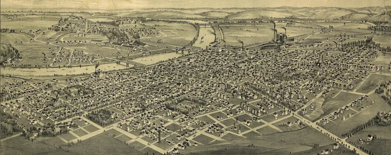
The 1884 History of Tuscarawas County says plainly that the whole county lies in the coal area. Its geology chapter then walks the reader seam by seam from Zoar Station to the Coshocton line, naming the hills, runs and mines where coal was dug for salt works, furnaces, canal boats and railroad engines. For a family historian, that chapter and the town and biography sections around it work as a map of where a miner or coal operator ancestor may have worked.
Written from The History of Tuscarawas County, Ohio (1884). Everything below comes from that book, and where it gives an opinion, we say so. You can read the full book free on the Internet Archive.
Seams numbered from the bottom up
The 1884 history describes every rock in the county as part of the coal measures and suggests that perhaps no other Ohio county shows the lower coal measures better. Geologists of the day numbered the seams from the lowest upward. Coal No. 1, the Massillon seam, had never been opened in the county. No. 3 was not workable anywhere the writers knew of. The seams that mattered were No. 5 and, above all, No. 6.
The book calls No. 6 one of the most important and widespread coals in the Ohio basin. It identifies the seam with the Big Vein of Columbiana County, the Osnaburg coal of Stark, the Steubenville and Rush Run coals of the Ohio Valley, and the Great Vein of Perry County, and says that in Tuscarawas it was mined more than any other. The coal was black, rather soft and highly bituminous, usually recognizable by its slate or sulphur parting.
Sulphur was its weakness. The history argued that if some cheap process could purify No. 6, it would be a source of great wealth to the county, good enough to smelt the local ore and even to draw Lake Superior ore to the coal. Above it lay Coal No. 7, known locally as the black-band coal because the county's black-band iron ore rested directly on it.
Mineral Point, Bolivar and Zoar
In the northern part of the county the working seam was No. 5, which the book says was extensively worked at Mineral Point and at the tunnel of the Tuscarawas Branch Railroad, with a maximum thickness of four feet. It describes the coal as hard and bright with about 5 per cent of ash, quick to kindle and slow to lose its fire, and notes that some of it made an excellent coke. On the south side of Huff's Run at Mineral Point the seam ran about four feet, and the writers judged it better there than anywhere else it had been opened in the county.
The same seam had been worked for many years near Bolivar, where it measured three to three and a half feet. Near Zoar it was dug in the mines of the Zoar Community west of the river, worked for some years by a Mr. Medill, where the seam had folded back on itself and thickened to thirteen feet. A similar fold turned up at Mineral Point in the mines of C. E. Holden. Miners driving an entry there struck a horseback of broken roof shale, cut through it, and found the coal doubled on the other side until the disturbed belt ended.
Mineral Point was a clay town as well as a coal town. Beneath No. 5 lay a hard flint clay that the book compares to the clay of the famous Mount Savage fire-brick, and it reports large fire-brick factories at Dover and Mineral Point, with flint clay also shipped to other counties. The shale above No. 5 carried most of the kidney iron ore used in the county, much of it mined by stripping on the valley slopes.
“Tuscarawas County lies entirely in the coal area, and no rocks come to the surface within its limits…”
Dover: salt, iron and brick
At Canal Dover a mine in Coal No. 5, near the Sugar Creek salt well, supplied the fuel for the saltworks. The Dover brine wells ran about 900 feet deep, and the book says seven barrels of brine made one barrel of salt, 280 pounds. On the west side of Sugar Creek, No. 5 gave three to three and a half feet of good coal. Between Dover and Trenton, No. 6 was mined at frequent intervals on both sides of the valley and was the chief source of fuel for the people living there.
The Dover blast furnace tied coal and ore together. The people of Dover built it in 1854 or 1855 on a $75,000 subscription, with Edmund Burnett as president. It lost money for the subscribers, passed to the Green Brothers, and in 1864 was sold to D. P. Rhodes and J. F. Card of Cleveland, who organized the Tuscarawas Iron & Coal Company. Rebuilt in the autumn of 1878, it was bought by the Pennsylvania Iron & Coal Company, incorporated November 19, 1881, with $200,000 in capital stock and J. P. Burton of Massillon as president. By the book's count the furnace made about fifty tons a day and employed about forty-five men, with a large number more at the mines and limestone quarries. About three-fourths of its ore came from the county, chiefly black-band ore the company mined in Fairfield, Jefferson and Auburn Townships.
The Dover Fire Brick Company, established by David Miller & Co. in 1869, later passed to Mr. Barrett and James F. Rhodes; the book counts about thirty hands and 8,000 bricks a day. Farm banks mattered too. Perry Stocksdale, a Baltimore-born farmer in Dover Township, opened a vein of coal on his land in 1873 that yielded an average of 150 tons a year.
Down the canal: Trenton, Port Washington and Newcomerstown
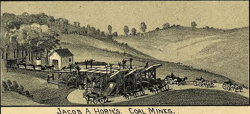
South of Dover, No. 6 was worked almost continuously. At Trenton and Newcastle it had been mined for many years and sent by canal to Cleveland, where, the book says, it earned a reputation as a strong coal for raising steam, though too sulphurous for iron making. At Port Washington the seam lay about 100 feet above the canal and ran five to seven feet thick, which the history calls very bright, black and handsome, but full of sulphur. No. 5 was opened at the furnaces below Port Washington, and on the river bank near Burton's ore-shoot it had once been worked and is said to have been four feet thick. At Lock 17, No. 6 was the only bed worked.
South of Newcomerstown, the book says, No. 6 was the only coal bed of importance all the way to the county line. It first shows at the Red Schoolhouse just south of the river, 135 feet above the railroad and only two and a half feet thick. At the Borth settlement in Oxford Township and along Bird's Run there were numerous openings in it. Elsewhere it was better, reaching four to five feet of good coal on Oldtown Creek, and in the northwestern part of the county the writers call it unusually good in the Sugar Creek valley around Dundee.
“When he came to Dennison, he was not worth $1, but is now worth several thousands…”
Uhrichsville, Dennison and the Stillwater
In the Stillwater valley the book found coal at many levels. At Dennison the principal No. 6 mine sat twenty-six feet above the railroad track in a bed three feet ten inches thick and free from slate. About three-fourths of a mile to the northeast was Morris' mine in the same bed, and on the west side of the valley at Uhrichsville was the mine of Mr. Andreas. In Pike Run the seam ran four and a half to five feet, and there were more mines beyond Hannatown. At Newport, No. 6 had been worked many years earlier but held so much sulphur that it was nearly worthless as fuel, and copperas was made from its pyrites. Near Newport, at Wallace's, a higher seam called No. 6 a was two and a half feet thick.
Dennison was a railroad town, placed by the Pittsburgh, Cincinnati & St. Louis Railway for its shops and offices, and its mines grew up to feed the engines. The Dennison Coal Company had extensive mines just south of town and a tram-way into the railway yard, where a large tipple coaled the locomotives; some coal also went to distant points. The book names Thomas Shipton, Jacob Pearch and O. S. Cummings among those formerly interested and says the company was then owned and run by Hurxthall, Allen & Graham, with about seventy miners at work.
The biographies fill in the people. Thomas Shipton, born in Pennsylvania in 1810, came back from the California gold mines with $4,000 in gold and put it into land; the Dennison coal mines were on that land, and he drew a royalty on all coal taken out. J. Pearch, a carpenter born in Carroll County, was a member of the Dennison Coal Mining Company and its manager while he was connected with it. A sketch of a Dennison man named Yeagley lists him among the organizers of the Dennison Coal Company. A. R. Graham, born in Canton in 1841, came to Dennison in 1881 as general superintendent and manager of the coal works. His sketch credits him with establishing a permanent paying trade there when others predicted failure, and says he expected soon to employ 400 men, far more than the seventy miners the town chapter counts.
Finding a mining ancestor in this book
The mining passages say little about the miners' own working lives. The only strike that surfaces, the big strike of February 1874, comes up in passing in a railroad carpenter-shop foreman's sketch. The biographies do show how men reached these mines. Sampson Brooks, born in North Wales in 1833, came to America in 1857, worked for some time in the Pennsylvania coal mines, and later settled at Dennison as a stone and brick mason. In 1863 he married Grace Ownes, also a native of North Wales. The book says he arrived in Dennison not worth $1 and came to own four houses and lots there.
For research, the strongest leads are the place and company names. Biographies are arranged by township: Dennison and Uhrichsville sketches appear under Mill Township, Newcomerstown under Oxford Township, and Canal Dover under Dover Township. Company names to search in deeds and newspapers include the Dennison Coal Company, the Tuscarawas Iron & Coal Company, the Pennsylvania Iron & Coal Company and the Dover Fire Brick Company. The book also names local papers that would have covered the mines, among them the Iron Valley Reporter at Dover, first issued May 10, 1872, and the Dennison Paragraph, founded December 13, 1879.
People from this history in our records
These Tuscarawas County residents have biographies on our site from the county histories, and each one mentions the mines. Their sketches name parents, spouses, and where the family came from.
- John Wolf (b. 1832)
Finding your ancestor in Tuscarawas County
- Census records (free through 1950) list each person's occupation and town, so a mining family shows up decade by decade.
- Death records: search our Ohio database by surname.
- The county histories themselves: the biographical sections of The History of Tuscarawas County, Ohio hold hundreds of family sketches.
- Newspapers on the Library of Congress's Chronicling America carried obituaries, accidents, and local news.
Tell us one grandparent's name. We'll take a free first look at the records and email you back.
Ask about my family →Frequently asked questions
Which coal seam was most important in Tuscarawas County?
The 1884 county history names Coal No. 6 as the seam mined more than any other in the county. It identifies it with the Big Vein of Columbiana County and the Great Vein of Perry County. The coal was soft and highly bituminous but carried a lot of sulphur, which the book saw as the main obstacle to using it for iron.
Who ran the Dennison coal mines in the early 1880s?
The book says the Dennison Coal Company, with mines just south of town and a tipple that fueled Pan Handle locomotives, was then owned by Hurxthall, Allen & Graham and employed about seventy miners. A. R. Graham was general superintendent. The mines sat on land owned by Thomas Shipton, who drew a royalty on the coal.
Where was coal mined near Mineral Point and Zoar?
Coal No. 5 was worked at Mineral Point, including the mines of C. E. Holden, and at the tunnel of the Tuscarawas Branch Railroad. Near Zoar it was mined by the Zoar Community west of the river, worked for some years by Mr. Medill. The book judged the seam on the south side of Huff's Run the best in the county.
Where did Tuscarawas County coal go?
According to the county history, coal from Trenton and Newcastle went by canal to Cleveland, where it was valued for raising steam. Dennison coal fueled railroad engines through a tipple in the Pan Handle yard and was also shipped to distant points. Dover coal fed the saltworks, and coal between Dover and Trenton heated local homes.
Photographs on this page are in the public domain. About the images and their sources.